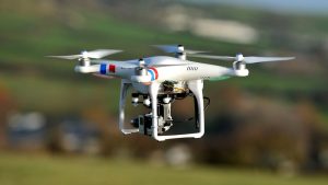
Drones are particularly useful in mining site surveying and management, from conducting land surveys to surveying potentially hazardous terrain or structures.
One such mining application lies in quarry surveying. Quarry landscapes are ever-changing, especially in a working mine, so these sites need to be scanned quickly and efficiently for planning, management, and reporting purposes. The collected data can be used to plan operations such as the positioning of mining equipment, blast surveying, stockpile inspection and the re-routing of access roads.
Increasing productivity, reducing lead times, and keeping costs down all make for greater efficiency and productivity. Research shows that drones can conduct land surveys and collect detailed data over vast areas at half the time of traditional surveying methods, meaning that what might have taken a surveying team 2-3 weeks to complete is easily completed via drone in 4-5 hours. Plus, drone-collected data can be easily and quickly transmitted back to operators for easy accessibility and distribution.
PLANNING AHEAD IS KEY
The survey maps generated by drone surveying can be used to plan quarry operations ahead of time. Proposed contours and directions can be created and compared to show how the quarry looks now and how it will look at the end of an excavation period. Topographical surveys can also be useful in the proposed development of a new quarry or site.
KEEPING A SAFE DISTANCE
A surveyor working in a quarry on foot would typically use a combination of GPS and a reflector-less total station to get data from working quarry faces. This is time-consuming and difficult work. Working on often difficult or even inaccessible surfaces and around large, heavy-duty machinery makes for a hazardous work environment. One of the greatest benefits of using a drone for quarry surveying lies in the safety factor – flying over a site means that the drone never has to land on the edge of a precarious quarry surface or get close to any mining equipment in use. Speed and easy operation also reduces the time of a surveyor must spend on the actual site while operators remain at a safe distance.
BIGGER, BETTER DATA
A drone’s point cloud can contain millions of points in comparison to the few thousand obtained from terrestrial surveying. Not only is drone data extensive and much more detailed than the results of traditional surveying practices, most drones deliver more than just raw data. They can generate maps, giving operators an overall view of the quarry site, projections for future changes, and a chance to identify potential issues and challenges.
 One such mining application lies in quarry surveying. Quarry landscapes are ever-changing, especially in a working mine, so these sites need to be scanned quickly and efficiently for planning, management, and reporting purposes. The collected data can be used to plan operations such as the positioning of mining equipment, blast surveying, stockpile inspection and the re-routing of access roads.